


053FTBEN1 - FORT BENNING1 Voting District, Chattahoochee County, Georgia
About
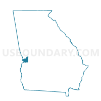
Outline

Summary
| Unique Area Identifier | 560599 |
| Name | 053FTBEN1 - FORT BENNING1 Voting District |
| County | Chattahoochee County |
| State | Georgia |
| Area (square miles) | 111.49 |
| Land Area (square miles) | 111.02 |
| Water Area (square miles) | 0.46 |
| % of Land Area | 99.59 |
| % of Water Area | 0.41 |
| Latitude of the Internal Point | 32.39058140 |
| Longtitude of the Internal Point | -84.72001370 |
Maps


Graphs
Select a template below for downloading or customizing gragh for 053FTBEN1 - FORT BENNING1 Voting District, Chattahoochee County, Georgia


Neighbors
Neighoring Voting District (by Name) Neighboring Voting District on the Map
- 0531 - ACTIVITY CENTER Voting District, Chattahoochee County, GA
- 053FTBEN2 - FORT BENNING2 Voting District, Chattahoochee County, GA
- 197339 - PINEKNOT Voting District, Marion County, GA
- 197807 - BUENA VISTA Voting District, Marion County, GA
- 197948 - BRANTLEY Voting District, Marion County, GA
- 215FTBEN1 - FORT BENNING1 Voting District, Muscogee County, GA
- 215FTBEN2 - FORT BENNING2 Voting District, Muscogee County, GA
- 215FTBEN4 - FORT BENNING4 Voting District, Muscogee County, GA
- 26306 - BOX SPRINGS Voting District, Talbot County, GA
Top 10 Neighboring County Subdivision (by Population) Neighboring County Subdivision on the Map
- Fort Benning CCD, Chattahoochee County, GA (8,306)
- Fort Benning CCD, Muscogee County, GA (7,881)
- North Marion CCD, Marion County, GA (4,523)
- Buena Vista CCD, Marion County, GA (4,219)
- Cusseta CCD, Chattahoochee County, GA (2,961)
- Junction City CCD, Talbot County, GA (1,781)
Top 10 Neighboring Place (by Population) Neighboring Place on the Map
Top 10 Neighboring Elementary School District (by Population) Neighboring Elementary School District on the Map
Top 10 Neighboring Secondary School District (by Population) Neighboring Secondary School District on the Map
Top 10 Neighboring Unified School District (by Population) Neighboring Unified School District on the Map
- Marion County School District, GA (8,742)
- Talbot County School District, GA (6,865)
- Chattahoochee County School District, GA (3,111)
Top 10 Neighboring State Legislative District Lower Chamber (by Population) Neighboring State Legislative District Lower Chamber on the Map
- State House District 130, GA (50,024)
- State House District 134, GA (47,935)
- State House District 148, GA (41,718)
Top 10 Neighboring State Legislative District Upper Chamber (by Population) Neighboring State Legislative District Upper Chamber on the Map
Top 10 Neighboring 111th Congressional District (by Population) Neighboring 111th Congressional District on the Map
Top 10 Neighboring Census Tract (by Population) Neighboring Census Tract on the Map
- Census Tract 108.02, Muscogee County, GA (6,454)
- Census Tract 9201, Marion County, GA (4,523)
- Census Tract 9202, Marion County, GA (4,219)
- Census Tract 201, Chattahoochee County, GA (2,961)
- Census Tract 9603, Talbot County, GA (1,781)
- Census Tract 202.03, Chattahoochee County, GA (1,141)
- Census Tract 202.06, Chattahoochee County, GA (204)